Thursday, May 14, 2009

Midstate Oregon and Portland

When I pitched my tent that evening I had tried placing the tent in a spot the sun strikes. With only one tree next to the spot, I chose poorly. The dew quickly dried after moving it into the sun, no problem. I just didn't stir as quickly. I wasn't particularly in a hurry. I just knew this was probably my last night camping.


I packed up and headed north, the final goal exceptionally close. I arrived in Eugene about three hours later and spent a bit of time there but it was at such a time that I didn't really want to stay. Portland was so close! A mere 100 miles away! But at the same time I didn't want to arrive in the evening either. I made the decision to ride north til I felt daylight had run out. I made it just 20 miles shy of Salem, 70 miles to Portland. Not much to say about that area regarding scenery. I didn't stop and pop any photos, really. The goal was about reached and couldn't pause to take pictures of fields and sheep. I stayed at a hotel (gasp!), allowing for a shower and semi-proper bed.

I got up the next and headed on up, the goal to arrive by Noon. After a rather uneventful hour and a half...
My Portland Arrival
I arrived at 11:57 am at my destination at the hostel I was staying at!

Now how can you celebrate such a thing? Well, you can have some awesome drinking chocolate...
Drinking Chocolate and Vespa

Or how about some excellent sake? Sayuri. Highly recommend it...
Sayuri

So here I am. Have been for a week. I got a place month to month and Monday will start the intense jobsearch, although I plan to get a resume out tomorrow for an available position. Will he score? I'll be the first to let you know! :)

Wednesday, May 13, 2009

Even more state parks...

I woke up fairly early and packed up the things, heading out about 9 that morning. Leaving the park by myself, no one there, was a bit creepy. I continued north...
Map 6

More plains, but in the distance I saw what appeared to be an odd cloud. It dawned on me; "Holy shit! That's a mountain!" My own personal "That's no moon!" moment. I marked my mileage, just to have an idea how distant I was and mark visibility.

After passing through Redding, it became clearer but more importantly so did the whole of the mountain range. Most of what was visible had snow on it. It dawned on me perhaps there wasn't a clear path across yet. Maybe I would have turn around or stay in Redding. Not cool! After reconsidering, I realized I was on the interstate and it was most likely clear all the way to the 'top', so i pressed on...
Up to Medford

Again, I can understand the boredom of Interstates. I specifically avoided I-10 when leaving Phoenix. No real scenery to speak of, long stretches of nothing. I-5 might be as repetitious, but it's definitely more lively with mountain passes like those above and plains right above them like those pictured below...
Oregon-California border plains

Yes, a dragon in the middle of nowhere...
California Field Dragons

I passed about 100 miles and stopped in Dunsmuir to refuel me and Natasha...
Downtown Dunsmuir
Scenic Dunsmuir

It's quite picturesque this time of year, but I can imagine it; Buried in snow with the sun barely peaking over the mountains in winter, just enough to snowblind you for an hour a day and make you snarl in anger and scream at it, begging it to actually melt this shit!!! But that could just be me.

I headed on and came upon Mt. Shasta and an outlying, conical sibling...
South of Weed
Mt. Shast Close-up

Little opportunity was offered to take pictures up til I got to Medford. But imagine again my surprise, 3 miles outside of Medford...
Pee-Honix, OR

Yeah. Right...

I arrived at Valley of the Rogue State Park, about 15 mileswest north of Medford. Again, brilliant park...
Valley of the Rogue state park

Edit; Please feel free to click on any of the images. They will take you into my Flickr photostream and non-clipped versions of many of the pics. Also of note; I was 90 miles from Mount Shasta when I first saw it. If I had been paying attention it could have been 100 miles. Amazing...

Monday, May 11, 2009

ACTUAL State Parks

Forgive the absence of anything even remotely referring to State parks in the last post. I've been in busy-mode, trying to get things accomplished and the blog is well down the list of things actually that important.

So, I left Alameda on the 6th and headed up to Red Bluff City. A note in regards to Google Maps, GPS units and the best laid plans of mice and men; No amount of careful planning can make up for a wrong turn. After the late experience on the PCH 1 and peoples' comments on how services dry up north of San Francisco, I decided to follow interstate 5 up through the middle of California. I left Alameda, following a written set of directions taped to the bike and a GPS unit in my pocket, narrating turns on the off occasion. These things did not prevent me from taking that 'wrong turn', going into San Francisco. It's not often I can say I really hated going to San Fran, but hey; The road system is complex and confusing at this point. I had no desire to get into a 'Gordian knot' there.

Actually the worst part was having to spring 4 bucks for the toll going over the bridge. I decided at that point to stop at Treasure Island and snap some pics to try to get some of my money back...
Treasure Island view
Treasure Island 250

After this little detour, I found the proper route and headed north towards Red Bluff. The route...
Map 5

At this point I cannot find anything particularly unpleasant to say about the northwestern part of this country. I'm sure it has it's crappy element of people, but terrain-wise it is absolutely beautiful. I do admit a fairly large number of insects suicided on my faceshield and scoot. At one point I'm pretty sure I passed through a cloud of hornets, only realizing what they were after I passed through. Lucked out and didn't get any in the jacket.

I was about 20 miles from my goal when 1) I saw the sign for the State Park and 2) saw this...
Northern California Sky

The State Park system is quite nice through the area. I never stayed at a campground that wasn't state the whole trip. Super-cheap, clean and maintained. (Guess I'm a bit of a socialist.) The only drawback to this one was the insects. Ants, mosquitoes and ticks. A proper tent kept them all at bay though. I'll probably make a post later about equipment that I had and what I wished I had...

Sunday, May 10, 2009

State Parks...

I had originally only planned for one day in the Bay Area. Upon looking at the weather forecast and looking at how far ahead I was over-all, I decided to stay another day in Alameda. I stayed with my friend Andy and his daughter Aurora...
Andy and Aurora

Alameda is a very odd duck, I find. If you're a Trekkie, it's where they kept the 'nuclear wessels'. A 2 mile island sitting off Oakland, the Navy base is pretty much history, although you can go tour a retired aircraft carrier there. No, what you'll not is that it's a pretty nice little suburbia. You'' swear the Huxtibles and the Bradies are neighbors...
Alameda Sidewalk

Have to run! More later...

Thursday, May 7, 2009

PCH-1, Part Deux

Ok, the Coast...

If you haven't done this ride, there are two things you should know. 1) June or July are optimal months to go. 2) More importantly, you need to do this ride. Here's the day and the PCH-1 sweet spot...
Map 4

After leaving Cambria, it stays pretty straight for a little bit, but not for long. The road begins beautiful, sweeping corners that demand your attention not only because they're fun to ride on (even on a load-bearing scooter), but the scenery is spectacular...
PCH 1
Bixby Bridge
Pacific Coast Hills

After Big Sur it pretty much goes back into 4-lane through San Francisco. The only short-point was the weather and I was told by amny souls along the way the optimal time is June-July. Still, I am ten shades of happy to have done this, especially on the Vespa. Not that it was hard; I just think the scooter was the ideal vehicle to do this particular leg of the ride on.

Thruough Santa Cruz the weather turned shitty. I mean REALLY shitty. I broke out the rain jacket and pants and that probably made the biggest difference in being able to get to Alameda. I stopped in Pacifica and ate at the diner where I called the bike tour off, just to make some sort of acknowledgement I'd been through the whole route I originally planned on the bicycle. Sure, it would have been great to have done it on the bicycle. That didn't happen. But this did. :) More in the next few days...

Tuesday, May 5, 2009

The Pacific Coast Highway, part 1

When I left Chatsworth on Day 3 I headed for Cambria on the 101 to get to the ever-so-coveted PCH-1. I covered 220 miles this route...
Map 3

The time of year might not be considered ideal for the coast. And probably for good reason. It was pretty nice going through Simi Valley...
Simi Valley Panoramic
I made the panoramic, so it looks a little funny!)

Made the Coast...
Breaching the Pacific Coast

And on up through the 101 through San Luis Obispo...
San Luis Obispo

And reached the PCH 1 proper. I was crossing the hill and went straight into some of the heaviest insta-fog I've experienced since the last time I was on this coast. I managed to find a campground, a few minutes of less fog and set up tent...
Foggy Scoot

My arrival was one of either very good timing on my part or luck. Maybe both. Although Natasha can really move, the average speed I've maintaned is less than a car. But several outings have taught me how to add time for all those odd stops for pics, food, gas, etc. But if the battle is lost, i.e. covering a certain mileage within a day, the war is seriously won. I've been putting more miles in than necassary for the alotted time in days.

I'll talk more about that over the next few days.

Monday, May 4, 2009

"So I went to Chatworth (again)

"And I met the President(again)..."

Day 2's route looked like this.
Map 2

I wanted to avoid LA's freeways as much as I could and chose this northern route through Apple Valley/Palmdale. Although scenic, it didn't allow for the LA Freeway escape and I had to take Highway 14 into Chatsworth. It wasn't as bad as one might think. Remain calm, keep your speed steady and all is cool. Escept for those little grooves in the road. I don't know why they scrape them in, possibly because it's concrete and wet concrete becomes very slick. All I know is motorcycles and scooters tend to shimmy a little on them. After getting used to it that wan't so bad, either.

I rolled into Chatsworth in the afternoon and saw my friend Dana and stayed with her family for the night...
Dana and Family

You would be hard-pressed to find a cooler set of people, in my opinion.

Dana took me to the Upright Citizen's Brigade presentation of Billy the Mime. Chances are he won't be in your area, but here is a sketch he does...


I will report more later, as I am in company and am being rude. Ta!

Friday, May 1, 2009

The oblivion that is the Southwestern Arizona Desert...

Wow. What can I say about the first day out? I managed almost 300 miles dead even getting to Yucca Valley in California. The route looked like this...
Day 1 map

And the scooter looked like this...
Scoot loaded to bear..

It's about 40 lbs of equipment. The biggest drawback isn't actually weight; It's wind resistance. It keeps top speed with a headwind down by about 10-15 mph. Sucky! It bounces around a bit when passing big trucks, but it keeps it's feet on the ground.

So what did I see first day out? Lots of this.
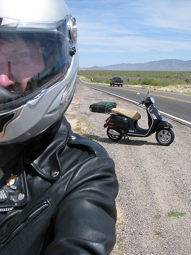
Desert Scoot

And this.
Check out the temp!

Actually after snapping this picture, it shot up to 104 degrees (!) All in all, still not intolerable. It dropped to 90-95 when moving. I wasn't sweating a lot, nor was Natasha. She just purred along. Thank you, water-cooling.

Also passed through Salome. This is almost the entire town in one picture.
Salome in all its glory

It's hard to believe how populated the desert is in actuality. People actually choose to live there. Incredible! Also it's a bit greener than people know. It's not the Mideast by any stretch.
Green Desert

Mahalo.